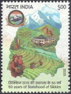
Stamp: Sikkim Statehood, 50 Years (India 2025)
Sikkim Statehood, 50 Years (India 2025)
29 May (India ) within release Sikkim Statehood, 50 Years goes into circulation Stamp Sikkim Statehood, 50 Years face value 5 Indian rupee
| Stamp Sikkim Statehood, 50 Years in catalogues | |
|---|---|
| Colnect codes: | Col: IN 2025.05.29-01 |
Stamp is square format.
Stamp Sikkim Statehood, 50 Years it reflects the thematic directions:
A landscape is the visible features of an area of land, its landforms and how they integrate with natural or man-made features. A landscape includes the physical elements of geophysically defined landforms such as (ice-capped) mountains, hills, water bodies such as rivers, lakes, ponds and the sea, living elements of land cover including indigenous vegetation, human elements including different forms of land use, buildings and structures, and transitory elements such as lighting and weather conditions. Combining both their physical origins and the cultural overlay of human presence, often created over millennia, landscapes reflect a living synthesis of people and place that is vital to local and national identity. The character of a landscape helps define the self-image of the people who inhabit it and a sense of place that differentiates one region from other regions. It is the dynamic backdrop to people’s lives. Landscape can be as varied as farmland, a landscape park, or wilderness. The earth has a vast range of landscapes, including the icy landscapes of polar regions, mountainous landscapes, vast arid desert landscapes, islands and coastal landscapes, densely forested or wooded landscapes including past boreal forests and tropical rainforests, and agricultural landscapes of temperate and tropical regions.
A map is a symbolic depiction emphasizing relationships between elements of some space, such as objects, regions, or themes. Many maps are static, fixed to paper or some other durable medium, while others are dynamic or interactive. Although most commonly used to depict geography, maps may represent any space, real or imagined, without regard to context or scale, such as in brain mapping, DNA mapping, or computer network topology mapping. The space being mapped may be two dimensional, such as the surface of the earth, three dimensional, such as the interior of the earth, or even more abstract spaces of any dimension, such as arise in modeling phenomena having many independent variables. Although the earliest maps known are of the heavens, geographic maps of territory have a very long tradition and exist from ancient times. The word "map" comes from the medieval Latin Mappa mundi, wherein mappa meant napkin or cloth and mundi the world. Thus, "map" became the shortened term referring to a two-dimensional representation of the surface of the world.
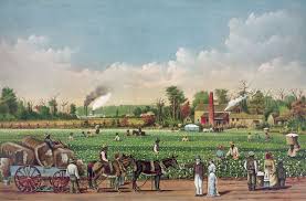
Plantations are farms specializing in cash crops, usually mainly planting a single crop, with perhaps ancillary areas for vegetables for eating and so on. Plantations, centered on a plantation house, grow crops including cotton, cannabis, coffee, tea, cocoa, sugar cane, opium, sisal, oil seeds, oil palms, fruits, rubber trees and forest trees. Protectionist policies and natural comparative advantage have sometimes contributed to determining where plantations are located.


