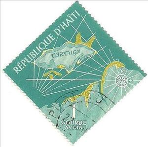
Stamp: Map of Tortuga Island (Haiti 1961)
Map of Tortuga Island (Haiti 1961)
04 April (Haiti ) within release Tourism. History of Tortuga Island goes into circulation Stamp Map of Tortuga Island face value 1 Haitian gourde
| Stamp Map of Tortuga Island in catalogues | |
|---|---|
| Michel: | Mi:HT 670 |
Stamp is square format.
Also in the issue Tourism. History of Tortuga Island:
- Stamp - Map of Tortuga Island face value 5;
- Stamp - Pirates face value 10;
- Stamp - Pirates face value 15;
- Stamp - Privateer in Battle face value 20;
- Stamp - Pirates face value 50;
- Stamp - Privateer in Battle face value 20;
- Stamp - Pirates face value 50;
- Stamp - Map of Tortuga Island face value 1;
Stamp Map of Tortuga Island it reflects the thematic directions:
A ship is a large watercraft that travels the world's oceans and other sufficiently deep waterways, carrying passengers or goods, or in support of specialized missions, such as defense, research and fishing. Historically, a "ship" was a sailing vessel with at least three square-rigged masts and a full bowsprit. Ships are generally distinguished from boats, based on size, shape and load capacity.

