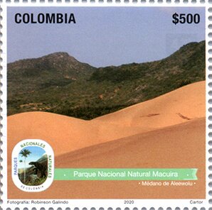
Stamp: View of Macuira National Natural Part (Colombia 2020)
View of Macuira National Natural Part (Colombia 2020)
06 June (Colombia ) within release National Parks of Colombia Series II (2020) goes into circulation Stamp View of Macuira National Natural Part face value 500 Colombian peso
| Stamp View of Macuira National Natural Part in catalogues | |
|---|---|
| Colnect codes: | Col: CO 2020-06f |
Stamp is square format.
Stamp from mini-sheet. Printed by Cartor Security Printings, France. Designed by Mónica Marcela Vargas. Serranía de Macuira is a mountain range in northern Colombia located in the municipality of Uribia, La Guajira. The Serrania de Macuira stands in the middle of the La Guajira Desert at 864 m isolated from the Sierra Nevada de Santa Marta and the Eastern Ranges of the Colombian Andes. The range is a protected area.The area is home to numerous species of fauna and flora and due to its relatively high humidity caused by the trade winds and its proximity to the Caribbean sea it presents a forest of dwarf trees and cloud forests. The frog Allobates wayuu is only known from the Serranía de Macuira.Also in the issue National Parks of Colombia Series II (2020):
- Mini Sheet - National Natural Parks, 60th Anniversary face value 9*500;
- Stamp - Arrau Turtle (Podocnemis expansa) face value 500;
- Stamp - Mapures Rapids, El Tuparo National Natural Park face value 500;
- Stamp - Blue-Throated Starfrontlet (Coeligena helianthea) face value 500;
- Stamp - Lake in Chizaca Sector, Sumapaz National Natural Park face value 500;
- Stamp - Vermilion Cardinal (Cardinalis phoeniceus) face value 500;
- Stamp - View of Macuira National Natural Part face value 500;
- Stamp - Scalloped Hammerhead Shark (Sphyrna lewini) face value 500;
- Stamp - Malpelo Island face value 500;
- Stamp - National Natural Parks Seal and Anniversary Emblem face value 500;
Stamp View of Macuira National Natural Part it reflects the thematic directions:
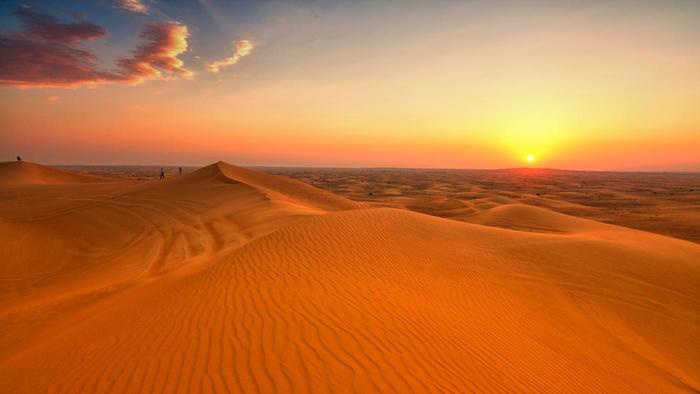
A desert is a landscape where little precipitation occurs and, consequently, living conditions create unique biomes and ecosystems. The lack of vegetation exposes the unprotected surface of the ground to denudation. About one-third of the land surface of the Earth is arid or semi-arid. This includes much of the polar regions, where little precipitation occurs, and which are sometimes called polar deserts or "cold deserts". Deserts can be classified by the amount of precipitation that falls, by the temperature that prevails, by the causes of desertification or by their geographical location.
A landscape is the visible features of an area of land, its landforms and how they integrate with natural or man-made features. A landscape includes the physical elements of geophysically defined landforms such as (ice-capped) mountains, hills, water bodies such as rivers, lakes, ponds and the sea, living elements of land cover including indigenous vegetation, human elements including different forms of land use, buildings and structures, and transitory elements such as lighting and weather conditions. Combining both their physical origins and the cultural overlay of human presence, often created over millennia, landscapes reflect a living synthesis of people and place that is vital to local and national identity. The character of a landscape helps define the self-image of the people who inhabit it and a sense of place that differentiates one region from other regions. It is the dynamic backdrop to people’s lives. Landscape can be as varied as farmland, a landscape park, or wilderness. The earth has a vast range of landscapes, including the icy landscapes of polar regions, mountainous landscapes, vast arid desert landscapes, islands and coastal landscapes, densely forested or wooded landscapes including past boreal forests and tropical rainforests, and agricultural landscapes of temperate and tropical regions.


